
Surveying – Mapping & GIS
Seven Structure supports organisations with accurate terrain and site data for informed decision-making. Our topographic surveys are trusted by:
 Architects & Planning Consultants: Accurate base mapping for feasibility, concept and detailed design
- Developers & Housebuilders: Reliable site information for layouts, access, earthworks and drainage
- Construction & Engineering Firms: Precise site levels and features for buildability and staging
- Highways & Infrastructure Teams: Corridor mapping, mobile mapping and large-scale terrain models
- Energy & Utilities Providers: Site conditions, access, contours and land constraints
- Local Authorities: High-accuracy surveys for transport, regeneration and public realm projects
- Landowners & Estates: Boundary validation, landscape design and property planning
Our topographical surveyors support diverse sectors, offering scalable survey solutions for every project size. Our trained topographical surveyors follow international and local standards in Measured Surveys of Land, Buildings, and Utilities. This means our teams receive a high level of training to deliver high-quality and cost-effective topographic surveys on sites.
Our commitment to sustainability extends beyond traditional survey methods. At 7 Consulting, we leverage aerial images using drones for topographic surveying for large sites, evaluating accuracy and cost-effectiveness and 3D topographic models can be made to offer a new perspective on your site’s landscape. Whether in 2D or 3D format, our detailed topographical surveys empower architects, developers, engineers and planners with unrivalled insights into your project.
We use drones with surveying-quality GPS unit or with an electronic EDM instrument, and the latest Robotic and Reflectorless Total Station instruments and 3D laser scanners to capture the site features. Once collated, every survey undergoes rigorous quality assurance before delivery, ensuring the highest level of accuracy.
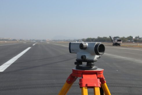

Land Surveying & Mapping
- Topographical Surveys
- Demarcation / Plot Boundary Marking
- Initial/Re/Final Demarcation for Trakhees
- Demarcations for Nakheel
- Gate Level Computations
- OGL (Original Ground Level) Survey
- Underground Utility Survey
- Underground facility location and as-constructed surveys
- Earthwork quantities & Excavation Quantity Calculations
- Legal surveys (subdivision, condominium, right-of-way surveys, easement and covenant surveys)
- Residential and commercial real property reports and building location certificates
- Construction and as-built surveys
- Remote sensing
- Cadastral base mapping
- Pre-engineering surveys
- Digital terrain modeling
- Preliminary roadway alignment selection
- Deformation monitoring
Aerial / Drone Mapping
- Construction Update Survey
- Mining & Aggregates
- Solar Energy
- Infrastructure Inspection
- Roofing Inspection
- Agriculture Inspections
- Urban Planning & Land Management
- Archaeology
- Land Survey
- Aerial photo and LiDAR data acquisition
3D Laser Scanning Services
- Industrial Applications
- Volume Calculations
- Infrastructure Applications
- Architecture Applications
- Archaeological/Heritage
- Energy
- Registered Point Cloud
- 3D CAD Models
- 3D Mesh Models
- BIM Models
- 2D CAD Documentation
- Plant Design Models
- Deformation Surveys
- Volume Survey
- Clash Detection
- 3D Virtual Reality
- Panoramic Images
- Leica TruView
- 3D laser scanning
Mobile Mapping
- Topographical Survey of Bulk / Huge areas
- Road Survey for thousands of Kilometers
- 3D Mapping of Large Areas in a shortime
Construction Survey & As-Built Survey of Buildings
- As-Built Survey of Existing Buildings
- Produce Floor Plan Drawings
- Produce Sectional Drawings
- Produce Elevation Drawings
- Produce Cloud Points
- Produce 3D Model of the Building
- BIM Modeling
- AutoCAD Modeling
- Industrial surveys
- Civil construction surveys
- Mechanical surveys
- Structural surveys
- Earthwork and volume surveys
- Piping surveys
- Engineering surveys for future construction and expansion projects
Construction Surveys
Establishment of Construction Benchmarks / Control Points
- Setting out of Construction Fence
- Setting out Pile Foundation
- Pile As-Built Survey Building Boundary Setting out Survey
- Column Marking, Footing Marking
- Grid Line Marking
- As-Built Survey of Existing Structures
- As-Built Surveys during Construction Stages
- Verticality Checking
- Tie Beam level checking
- All Construction Related Survey Services
Concrete Inspection Services
- Locate rebars, tendons, metal
- Locate plastic conduits, glass-fibre cables, voids etc.
- Avoid hitting concealed objects when drilling or sawing
- Checking of rebar and tendon layout (e.g. curvature, density, depth)
- Inspection of floors, decks, slabs, balconies, etc in structures
- Detection of voids and cavitie
What’s Included in Our Topographic Survey?
A topographical survey report from Technics typically includes the following:
- Building footprints & structures
- Boundary lines & fencing
- Natural land features (trees, slopes, embankments)
- Drainage & utility covers
- Roads, paths & access points
- Contours & elevation data
Underground Surveying
Our specialist Underground Utilities team harnesses the latest survey technology, including dual-frequency ground penetrating radar (GPR), to locate and trace services below ground, including sewers, gas mains, heating and water, lighting cables, BT telephone lines, other communication cables and traffic signalling cables.
In addition to locating utilities, our underground surveys provide detailed data on below ground conditions ahead of any site excavations, drilling, piling or borehole clearance. Using GPR and electromagnetic equipment, we can identify and position underground features such as voids, steelwork, shafts and graves which could impact on future construction activity.
For more complex projects, additional elements like adjacent site features, detailed underground mapping, and volumetric calculations can be included.